

Aerial Imaging Saudi Arabia (AISA) is a full-service Aerial Survey & Geospatial Solutions provider based in Riyadh, KSA. Catering exclusively to the Kingdom’s unique needs & requirements. Offering a spectrum of Customized Solutions to Public and Private sectors. Innovation, Mobilization, Integration, Monitoring and Flexibility are the set of Values that we stand for.
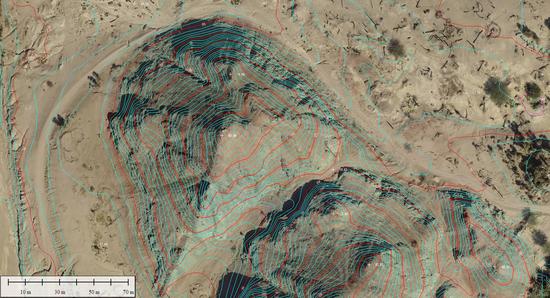
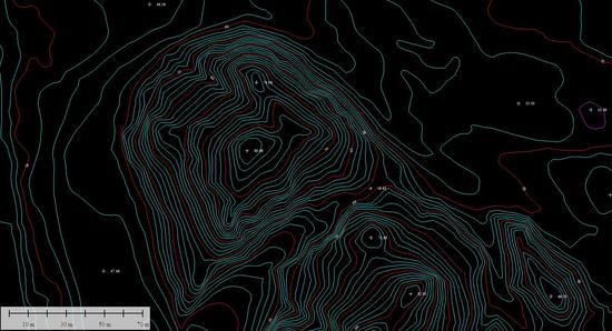
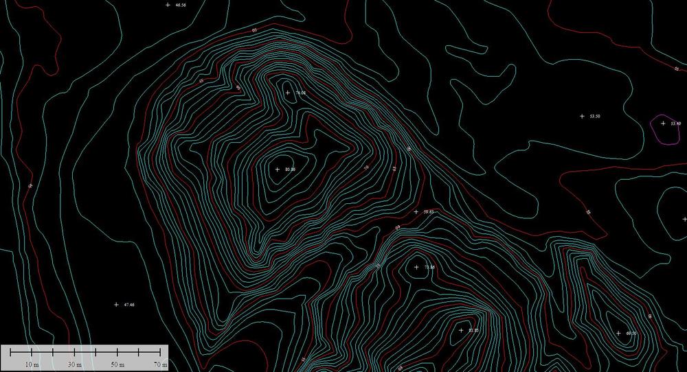
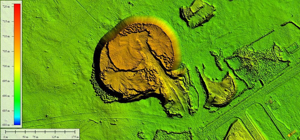
Contact UsThe company also produces Contour Maps from the data collected off Aerial Surveyies. Those Contour Maps shows the hierarchy of the site and shows the heights and decreases and level of gradation, by any terminator starts from 25 cm and extends to several meters and according to the request of the client, and can use the contour map with the aerial image and thus appear as a background image of the contour map As confirmation of the contour lines on the ground.
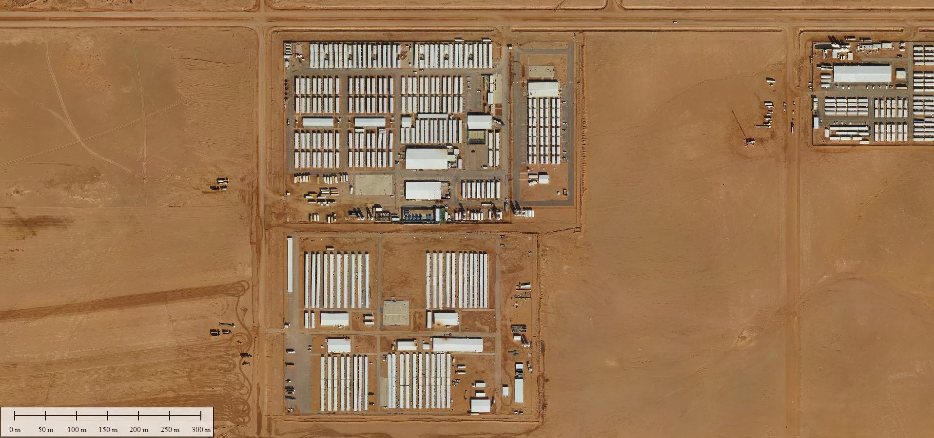
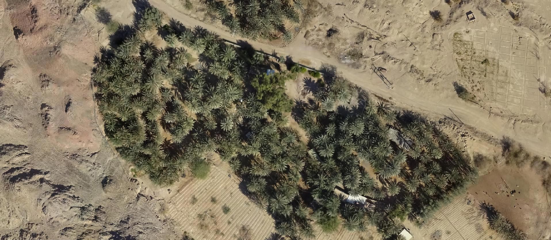
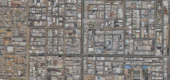
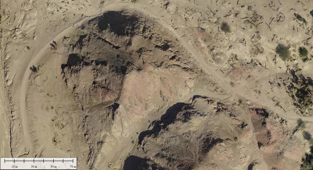
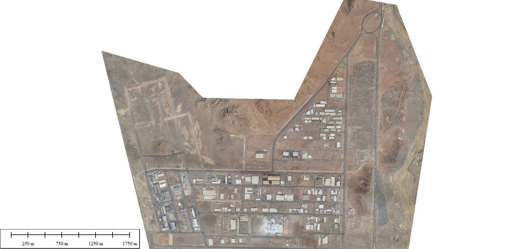
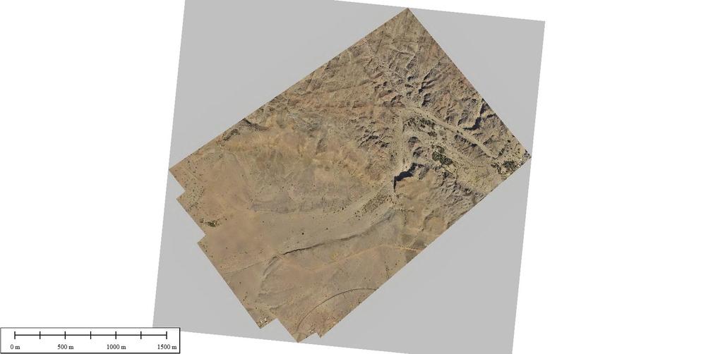
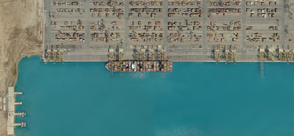
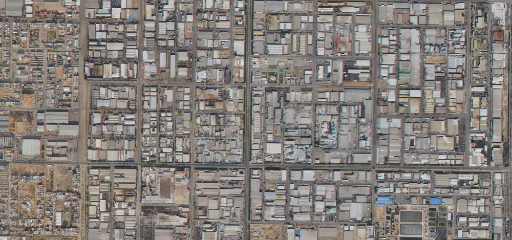
AISA also use special techniques to process and create digital true orthophoto from 2 cm to 40 cm image resolution.

AISA also use special techniques to process and create digital true orthophoto from 2 cm to 40 cm image resolution.
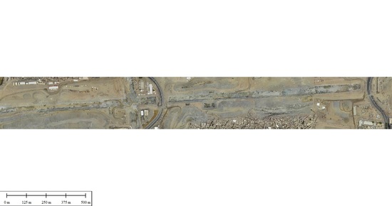
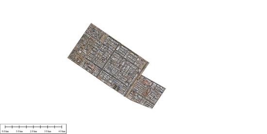
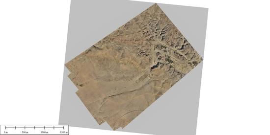

Whether you require a first generation base map or the next generation 3D fly-through. We apply the most appropriate technology to produce comprehensive and rich digital orthophotos.
Fully detailed Digital Terrain Models (DTMs) for Contour Generation and Flood Plain Mapping as well as Digital Elevation Models (DEMs) for specialized applications such as 3D Modeling and Volumetric Calculations.

Fully detailed Digital Terrain Models (DTMs) for Contour Generation and Flood Plain Mapping as well as Digital Elevation Models (DEMs) for specialized applications such as 3D Modeling and Volumetric Calculations.
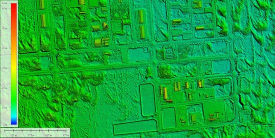
AISA create a DSM that is especially useful in 3D modelling because objects extrude from the Earth, and it is relevant in Telecommunications, Urban Planning, Aviation and Forestry, etc.
You should view the Earth’s Surface in Stereo 3D glasses. Unlike applications such as Sketchup and CityEngine, the approach we use in here is to provide Monocular Cues like Relative Size and Linear Perspective which gives a full perspective of a 3D perception.
You should view the Earth’s Surface in Stereo 3D glasses. Unlike applications such as Sketchup and CityEngine, the approach we use in here is to provide Monocular Cues like Relative Size and Linear Perspective which gives a full perspective of a 3D perception.
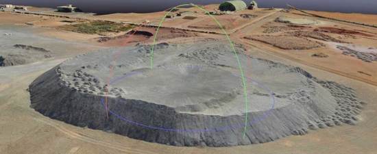
AISA have carried out Volumetric Surveys all over Saudi Arabia. The Survey Data is collected by UAV techniques based on Ground Control Points. This data is processed to shape a 3D Digital Terrain Model (DTM) which forms the basis for Volume Calculations, Surface Area Measurements and Cross Sections.
In a three-dimensional coordinate system, these points are usually defined by X, Y, and Z coordinates, and often are intended to represent the external surface of an object. For example, in Aerial Survey and GIS, point clouds are one of the sources used to make digital elevation model of the terrain .They are also used to generate 3D models of urban environment

In a three-dimensional coordinate system, these points are usually defined by X, Y, and Z coordinates, and often are intended to represent the external surface of an object. For example, in Aerial Survey and GIS, point clouds are one of the sources used to make digital elevation model of the terrain .They are also used to generate 3D models of urban environment
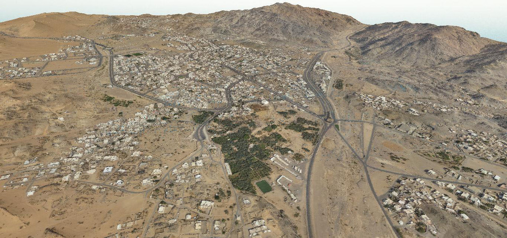
AISA specialized in generating 3Dfly through using a DSM and aerial orthophotos over Saudi Arabia. This data will be acquired as part of deliverables for each project based on high resolution aerial imagery.
Because we know exactly how to reach our exact given Targets within the exact given Budget and the exact given Timeframe. Our Mobilized and Flexible capabilities are catering all needs of all Sizes and all Sectors.
To Mobilize our highly qualified staff carrying out our clients Objectives all over Saudi Arabia. Offering Innovative Technologies and Monitoring Tools that makes it easy to Capture & Report any data in any place.
A first class deliverables of real-time data captured & reported using the Best Practices in the field leveraging not only our Top Technologies, but also our International Cooperative Work Agreements to achieve the maximum client Satisfaction and Loyalty.


