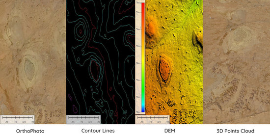
Our aerial division caters to all your needs; from flight planning and dedicated aerial image collection projects to conducting tailor-made aerial surveys in Saudi Arabia. Including geo-referenced, Orthomosaics and Digital Elevation Models. We...
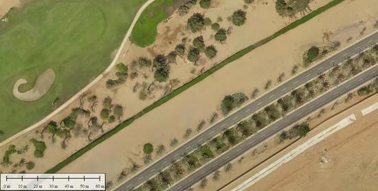
Aerial Imaging Saudi Arabia (AISA) can dispatch crew across Saudi Arabia to capture real time conditions to help farmers to make timely decision on the health of their crop. AISA focus on yields. The imagery products including color,...
Agriculture Monitoring
Agriculture Monitoring
Aerial Imaging Saudi Arabia (AISA) can dispatch crew across Saudi Arabia to capture real time conditions to help farmers to make timely decision on the health of their crop. AISA focus on yields. The imagery products including color,...
AISA team use small UAVs to help you cost effectively monitor all phases of your construction activities from site preparation through to project completion. Easy to manage, portable and flexible in their ability to get quickly to otherwise...
Aerial Imaging Saudi Arabia (AISA) is a complete software development company that offers programming, design, and consulting services to a wide range of industries and businesses. Working tirelessly with our clients, we are able to execute a...
GIS Services & Solution
GIS Services & Solution
Aerial Imaging Saudi Arabia (AISA) is a complete software development company that offers programming, design, and consulting services to a wide range of industries and businesses. Working tirelessly with our clients, we are able to execute a...

Land Surveying is the technique, profession, and science of determining the position of points and the distances and angles between them for use in locating property boundaries, construction layout & map making, We provide land surveying...